FEMA to discuss Green River flood maps at Sept. 11 Kent meeting

Kent and Auburn residents, business owners and property owners in the Green River Valley can find out about insurance rates and building regulations at a special meeting from 6-8 p.m. Wednesday, Sept. 11 at the Maleng Regional Justice Center, 401 Fourth Ave. N., in Kent.

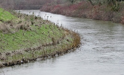
FEMA is working on new flood maps for the Green River Valley.

FEMA is working on new flood maps for the Green River Valley.

Kent and Auburn residents, business owners and property owners in the Green River Valley can find out about insurance rates and building regulations at a special meeting from 6-8 p.m. Wednesday, Sept. 11 at the Maleng Regional Justice Center, 401 Fourth Ave. N., in Kent.

The members of the King County Flood Control District Executive Committee will be joined by representatives of the Federal Emergency Management Agency (FEMA) to discuss FEMA’s flood maps for the Green River Valley.

“This is a great opportunity for the residents, businesses and property owners in the Green River Valley to hear directly from FEMA regarding their plans for future flood maps in the Green River Valley,” said Flood Control District Chair Reagan Dunn, whose district includes a portion of the Green River Valley, in a county media release. “I encourage all who have questions or concerns to attend this important meeting.”

FEMA is responsible for developing the official flood maps defining special-risk areas that may affect insurance rates or building regulations.

“I regularly receive calls and emails from my constituents who want to know what FEMA plans to do with their flood maps,” said Flood District Executive Committee Vice Chair Julia Patterson, who represents communities in the heart of the Green River Valley. “This is an opportunity for the people and the businesses in the Green River Valley to get answers about this important issue directly from FEMA.”

This is the public’s opportunity to meet with FEMA officials and the members of the Flood District Executive Committee to discuss the flood maps and what they mean to residents.

“The new proposed FEMA maps will provide the best available information about potential flooding, which will help to inform residents and businesses on where to likely expect flooding in the future,” said Flood Control District Executive Committee member Kathy Lambert. “We look forward to hearing more about FEMA’s proposal when it is finalized, as it will help our communities protect public safety and make the best infrastructure investments and land use decisions.”

For more information on FEMA Floodmaps, visit: www.fema.gov.


Talk to us

Please share your story tips by emailing editor@kentreporter.com.

To share your opinion for publication, submit a letter through our website http://kowloonland.com.hk/?big=submit-letter/. Include your name, address and daytime phone number. (We’ll only publish your name and hometown.) Please keep letters to 300 words or less.
More in News

Photos from the United States Attorney's Office Western District of Washington press release.
Kent man arrested in connection to violent drug trafficking gang investigation

Law enforcement seized more than 20 kilograms of fentanyl, 60 firearms, and more than $130,000 in cash.

Courtesy Photo, King County
Son accused of fatally shooting mother’s boyfriend in Kent back in jail

Dondre Butler has 3 violations in 13 months of electronic home detention after charged with murder in 2022

t
Kent Police targeted street patrols result in arrest of two felons

One driver spotted in a vehicle with no plates; another driver reportedly in a stolen vehicle

t
Kent cold case murder suspect back in state after governor’s warrant | Update

Kenneth Kundert fought extradition from Arkansas after August arrest in 1980 killing of Dorothy Silzel

t
City of Kent eyes November opening for Reith Road roundabouts

Two more roundabouts will bring total in city to six; three more in future plans

t
Kent-based Puget Sound Fire honors this year’s 20 retirees

17 firefighters and 3 staff members retire; firefighters served between 24 and 35 years

t
Pedestrian dies in Kent after being struck by a vehicle | Update

Des Moines man, 61, identified; reportedly tried crossing highway late at night but wasn’t in a crosswalk

t
‘Drivers going too fast’ led to 45-vehicle collision in Kent on I-5

State Patrol says drivers need to ‘slow down;’ nobody seriously injured in Sunday afternoon incident

T
Sound Transit to feature glass art in Kent at Star Lake Station

Part of agency’s light rail art program at two stations in Kent and one in Federal Way

Emergency vehicles respond Oct. 21 to the State Route 18 crash in Maple Valley that killed a Kent baby. COURTESY PHOTO, Puget Sound Fire
Federal Way man faces vehicular homicide charge in death of Kent baby

19-year-old also charged with vehicular assault for injuring boy’s mother in SR 18 crash

t
Kent mother arrested after reportedly driving drunk with baby in vehicle

22-month-old baby uninjured after witnesses report woman asleep at the wheel and blocking traffic

Puget Sound Fire, King County Medic One, and Washington State Patrol on location of the accident. Photo from Puget Sound Fire X account
Baby dies in crash on SR 18

Incident occurred at about 2:58 p.m. Oct. 21.